

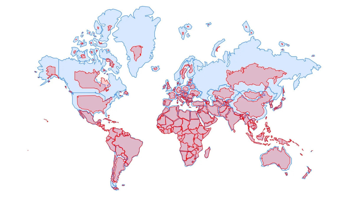
Member States on Friday endoresed resolution promoting map projections that more accurately reflect the true size of continents.
The corresponding resolution was supported by 164 Member States. The document urges national governments, educational institutions, international organizations, and technology corporations to adopt more precise equal-area projections, with a primary emphasis on the Equal Earth projection.
The resolution does not ban the Mercator projection or impose a replacement. Instead, it encourages governments, schools, international organizations and technology companies to use the Equal Earth projection and other so-called equal-area maps when relative size matters.
Kazakhstan’s Cartographic Profile Undergoes Visual Adjustment
The implementation of the new projection significantly change the visual perception of Kazakhstan’s territory. While the Republic retains its extensive sovereign landmass, the transition to a map that accurately reflects surface area provides a more compelling visualization of its scale relative to European nations.
Under the Mercator projection, European territories receive a visual exaggeration of their size; conversely, the adoption of equal-area mapping facilitates a far more accurate representation of the spatial ratio between Kazakhstan and European states.
