

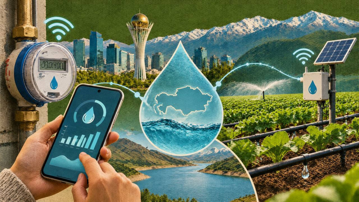
Digital technologies cannot create new water resources, but they can identify where water is being lost, who receives it and in what quantities, and when agricultural land actually requires irrigation. For Kazakhstan, with its arid climate, deteriorating irrigation infrastructure and dependence on transboundary rivers, such monitoring and accounting are becoming an integral part of water security. Smart meters, soil moisture sensors, automated gates, satellite monitoring and an integrated information system are gradually being brought together into an infrastructure designed to replace decision-making based on estimates with data-driven water management, El.kz reports.
When every drop becomes data
Water scarcity is generally perceived as a natural phenomenon caused by low precipitation, hot summers and reduced river flows. However, a significant proportion of water losses occurs after water has already entered the economic system. Water seeps through unlined canals, escapes through undetected damage to pipelines, is supplied to agricultural fields according to standardised schedules and is consumed without accurate metering. Under these circumstances, the construction of new infrastructure remains essential, but without reliable measurement, it does not address the underlying causes of inefficiency.
In his Address to the People of Kazakhstan on October,28, 2026, President Kassym-Jomart Tokayev emphasised that “the problem of water resource scarcity in our country requires systemic and decisive measures”. The President instructed the Government to strengthen control over water consumption, reduce distribution network losses and complete the development of the National Water Resources Information System. Another statement in the Address establishes the overarching principle of the reform: “Responsible and prudent water use must become a mandatory principle of economic activity.”
A year earlier, the Head of State had described water as a strategic resource and proposed consolidating information on surface water and groundwater reserves on a digital platform using artificial intelligence. The rationale behind these instructions is straightforward: it is impossible to conserve a resource whose volume and movement are only approximately known to public authorities, utility operators and consumers.
Smart Meters Detect What the Human Eye Cannot
A conventional water meter records cumulative consumption and requires periodic manual readings. A smart meter does this automatically: it measures water consumption, transmits data to an information system and generates a time-based consumption profile. If water continues to flow unexpectedly during the night or consumption rises sharply within a short period, the system can detect an anomaly before a leak becomes visible.
In 2026, Kazakhstan introduced new requirements for water supply metering devices. NB-IoT and LoRaWAN technologies were designated for remote data transmission. New devices must be compatible with information and measurement systems and the unified Smart Turmys digital platform for housing and utilities. At the same time, properly functioning meters are not subject to premature replacement: the new requirements apply to initial installations or the replacement of equipment that has reached the end of its service life or become inoperative.
For water utilities, telemetry means more than accurate billing. By comparing the volume of water supplied to a section of the distribution network with the combined readings of individual consumers, operators can identify areas with potential hidden losses. Such data help detect emergencies more quickly, plan maintenance and assess whether corrective measures have achieved the intended results. For consumers, transparent consumption records turn water conservation from an abstract appeal into a measurable outcome.
Digital Canals Regulate Water Flows Automatically
Measuring water consumption in irrigation systems is considerably more complicated than in residential buildings. Water travels dozens or even hundreds of kilometres through open canals, water levels fluctuate depending on supply volumes and weather conditions, while manual gate adjustments do not allow operators to respond immediately to changing circumstances. Automation introduces flow meters, water-level and pressure sensors, electric actuators and centralised dispatch control systems. Operators can monitor water flows in real time and remotely adjust gate positions or pump operations.
In 2026, the Ministry of Water Resources and Irrigation reported that 283 irrigation canals in the southern regions of the country were being automated. Existing systems are also undergoing modernisation. Under projects implemented with support from the World Bank, water-level and pressure sensors transmit information to a central server, while pumping stations can be operated remotely. Over 100,000 hectares have benefited from improved irrigation and drainage services, including digital monitoring and control.
The importance of this technology lies not in the equipment itself, but in the speed of response it enables. If water levels begin to decline, the system helps operators distinguish between a scheduled change and a leak or unauthorised withdrawal. If water levels approach a critical threshold, supply can be adjusted before an overflow occurs. Accumulated data also reveal which sections of a canal experience the greatest losses and where reconstruction would deliver the highest impact.
Satellites Monitor Rivers and Reservoirs
Satellite-based monitoring is important not only for agriculture. Satellite imagery makes it possible to measure changes in the surface area of water bodies, monitor reservoir dynamics and assess the condition of river catchment areas. For Kazakhstan, a significant share of whose water resources originates in transboundary rivers, independent monitoring is essential both for domestic water planning and for negotiations with neighbouring countries.
Algorithms can regularly compare new satellite images with previous observations and flag significant changes. They do not replace hydrologists or determine precise water volumes based on a single image, but they help identify areas requiring further inspection. Combined with ground-based monitoring stations, meteorological data and river flow models, satellite monitoring becomes part of an early warning system for low-water conditions, floods and unusual reductions in water surface area.
One Integrated System Instead of Disconnected Spreadsheets
On September, 8, 2026, the National Water Resources Information System was commissioned for full-scale operation. It consolidates information on water bodies, infrastructure, water users and groundwater resources. By the time of its launch, the system had structured data on more than 23,000 facilities and water bodies, including 17,758 rivers, 3,148 lakes and 1,207 hydraulic structures.
The National Water Resources Information System is intended to support water balance assessments, water accounting and consumption analysis, reservoir monitoring, the management of transboundary water data and satellite-based monitoring. The platform’s value will depend not on the number of records entered into the system, but on how regularly the information is updated and used in decision-making. Faulty sensors, incomplete reports or incompatible data formats may simply transfer existing uncertainties into a new digital environment.
A separate digital framework has also been introduced for relations with agricultural producers. In 2026, contracts with Kazvodkhoz for the supply of irrigation water were transferred to a billing system. By early November, 29,283 electronic agreements had been concluded, 2,570 more than in the previous year. An electronic contract does not directly save water, but it makes allocation limits, beneficiaries, service volumes and outstanding payments transparent, reducing the scope for unaccounted water distribution.
Water Savings Are Already Measurable
According to the Ministry of Water Resources and Irrigation, as of September,1, 2026, water-saving technologies were being used on 702,300 hectares, representing 36 per cent of the country’s total irrigated land. In 2023, the figure stood at 237,100 hectares. Over three years, the coverage nearly tripled, primarily due to the expansion of drip and sprinkler irrigation systems.
The Ministry estimates that modern irrigation systems reduce water consumption by an average of 20–30 %, although actual results depend on the crop, soil type, terrain and condition of on-farm irrigation networks. By the end of 2025, the application of water-saving technologies across 543,500 hectares had generated estimated savings of approximately 874 million cubic metres of water. By 2030, the Government plans to expand coverage to 1.3 mln hectares and achieve annual water savings of up to 2.2 bln cubic metres.
These figures cannot be attributed to digitalisation alone. The results are achieved through a combination of drip irrigation systems, sprinkler equipment, canal reconstruction, land levelling, tariff policies and monitoring. Digital tools perform an integrating function: they measure the impact of interventions, determine the timing of water delivery, identify losses and enable actual consumption to be compared against established allocation limits.
Technology Does Not Eliminate Accountability
A smart meter is of little use if its readings are not analysed. An automated gate will not reduce water losses in a deteriorating canal. An algorithm cannot correct inaccurate input data, and satellite monitoring cannot replace pipeline repairs. Digitalisation requires sensor maintenance, reliable communications, data protection, common technical standards and qualified professionals capable of translating data flows into practical management decisions.
When properly implemented, however, these technologies transform the very principles of water governance. Instead of responding to shortages after they have occurred, public authorities and water operators gain the ability to identify rising consumption in advance, forecast demand, redistribute water supplies and evaluate the results of their decisions.
In a country where the strategic value of water will only continue to grow, the true impact of digitalisation should not be measured by the number of devices installed, but by the volume of water that has been successfully prevented from being lost.
